gis-urban-planning-modern-cities
GIS – Transforming Urban Planning in Modern Cities
Introduction
Urban planning is undergoing a major transformation driven by rapid urbanization, infrastructure demands, and the need for sustainable development. At the heart of this shift is Geographic Information Systems (GIS) — a powerful technology enabling planners to make informed, data-driven decisions.
Unlike traditional methods, GIS integrates multiple layers of spatial data, offering a dynamic and intelligent approach to managing modern cities.
What Is GIS in Urban Planning?
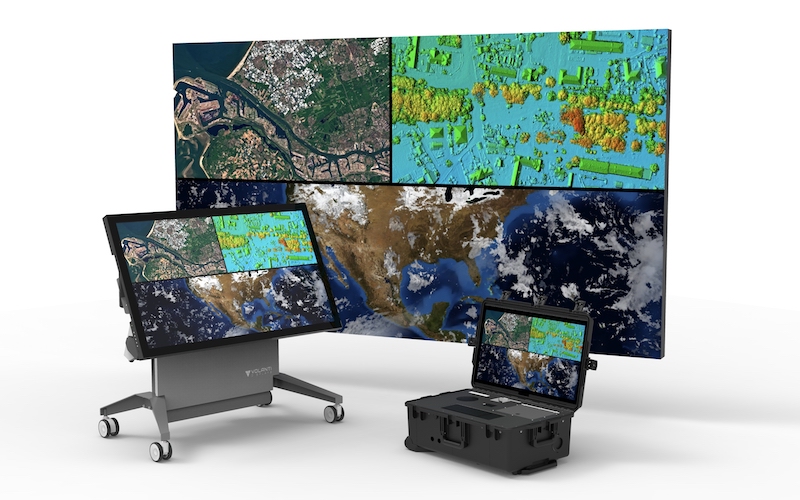
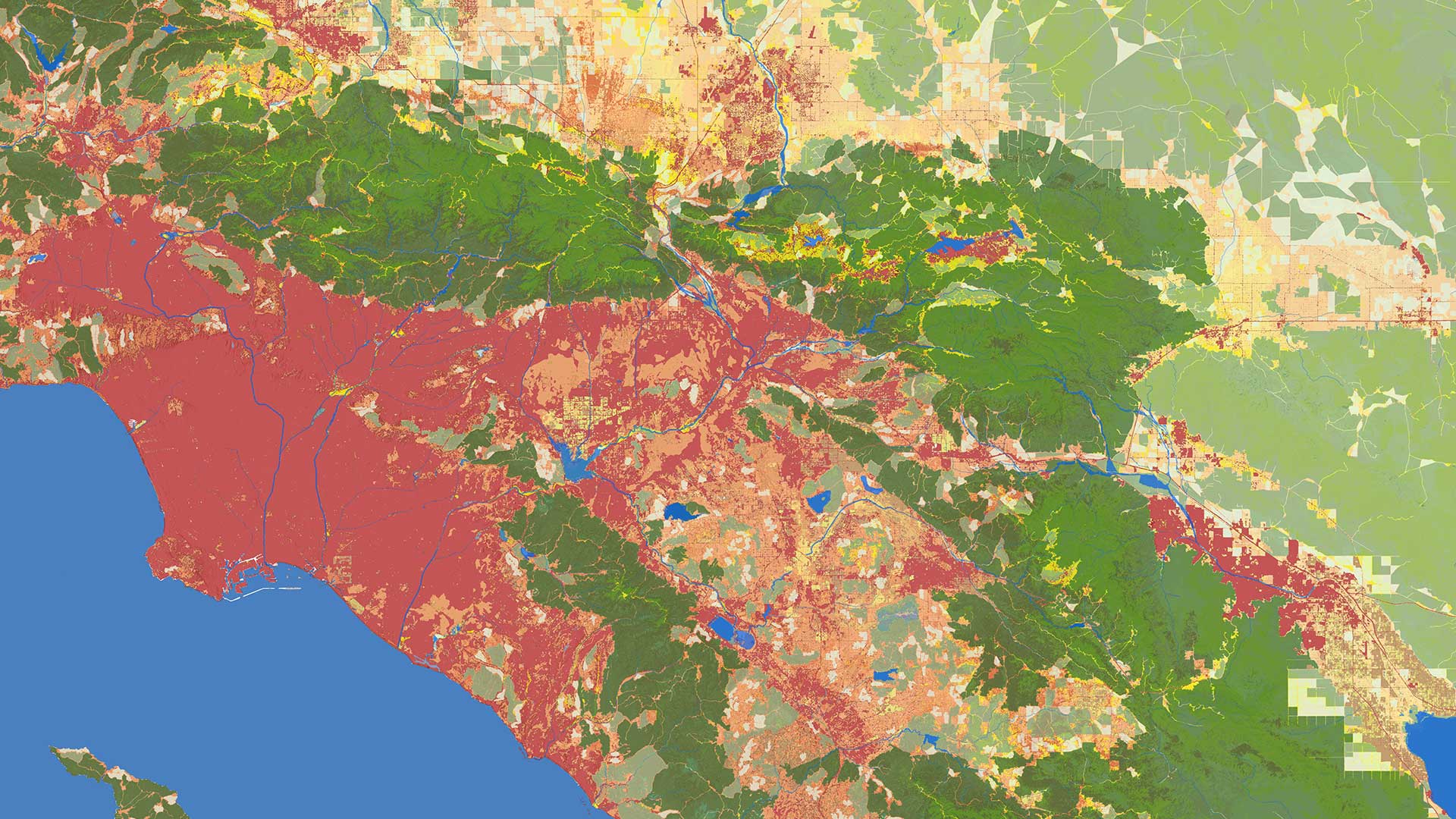
GIS (Geographic Information Systems) is a framework used to collect, analyze, and visualize spatial or geographic data.
Popular tools such as ArcGIS and QGIS allow planners to combine datasets like:
Population density
Land use
Transportation networks
Environmental data
This enables a comprehensive understanding of how cities function and evolve.
From Traditional Planning to Smart Mapping

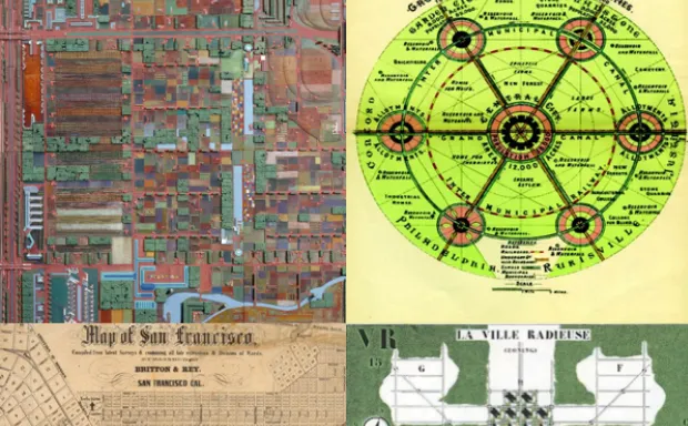

Traditional planning relied heavily on:
Static maps
Field surveys
Historical records
While effective, these approaches lacked real-time insights and scalability.
GIS introduces:
Real-time data integration
Interactive digital maps
Predictive spatial analysis
This shift allows planners to simulate and visualize future developments before implementation.
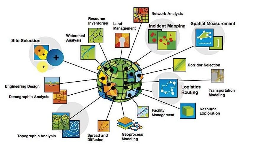
Key Applications of GIS in Urban Planning
1. Data-Driven Decision Making
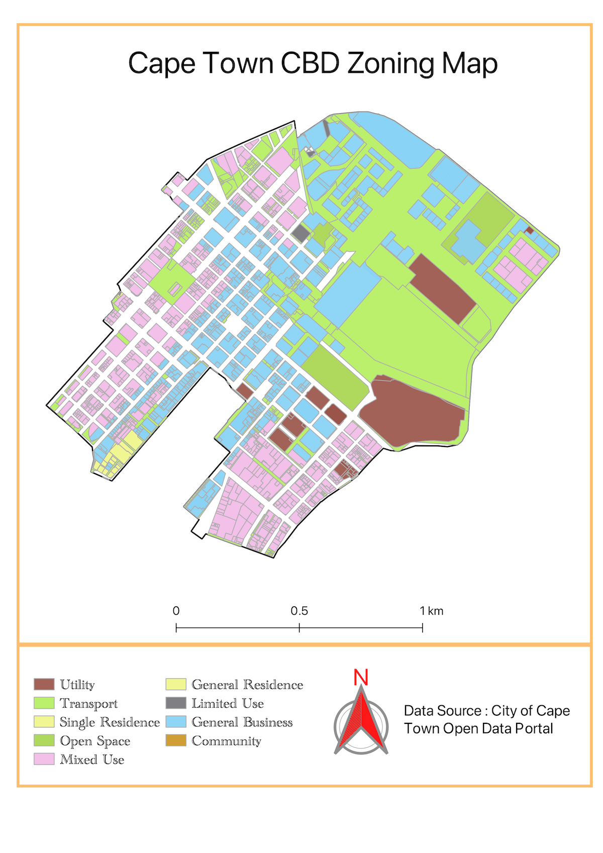
GIS enables planners to overlay multiple datasets, helping identify patterns and relationships that inform better decisions on zoning and land use.
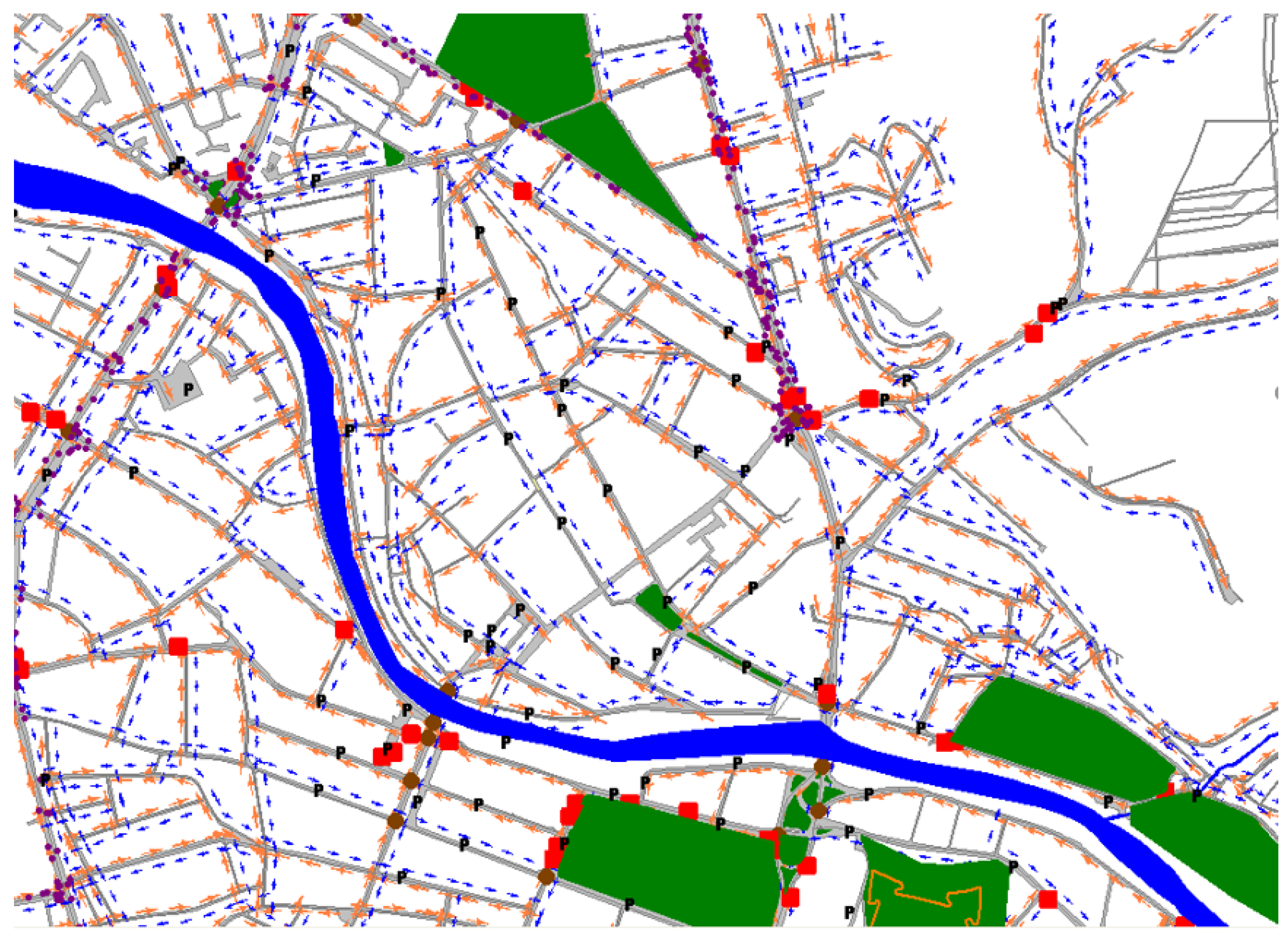
2. Infrastructure Development


GIS supports efficient planning of:
Road networks
Water and drainage systems
Power and communication lines
By analyzing terrain and population distribution, infrastructure can be optimized for both current and future needs.
3. Environmental Management
GIS helps monitor and protect the environment by:
Identifying sensitive ecosystems
Tracking pollution levels
Supporting sustainable land use planning
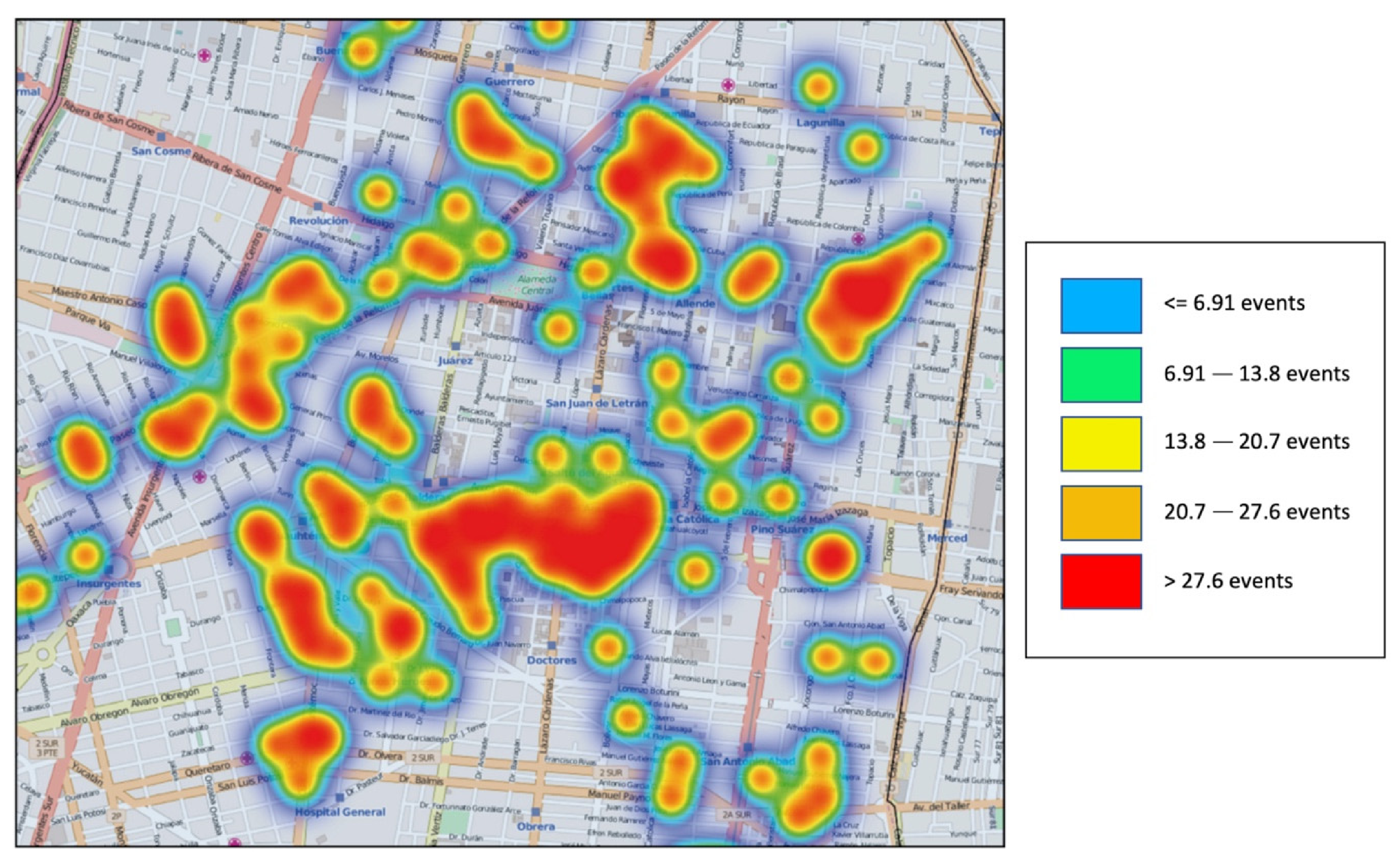
4. Disaster Risk Management

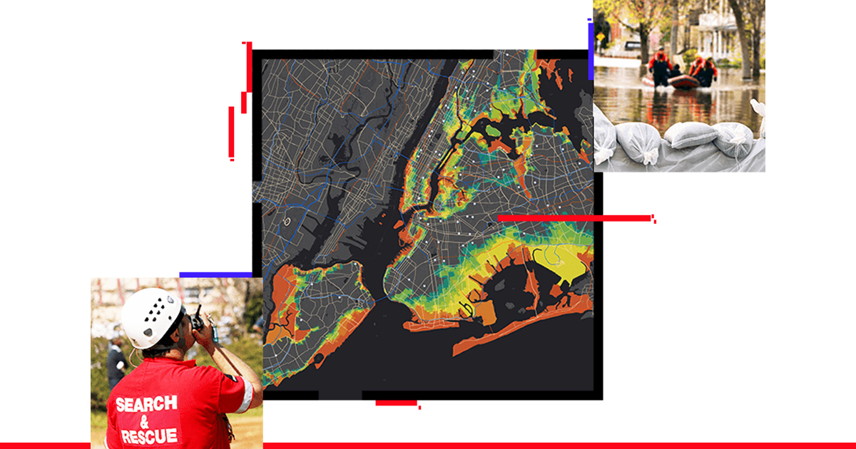

Urban planners use GIS to:
Map flood-prone areas
Identify risk zones
Plan evacuation routes
Improve emergency response systems
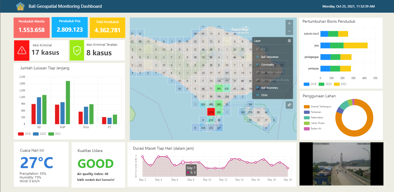
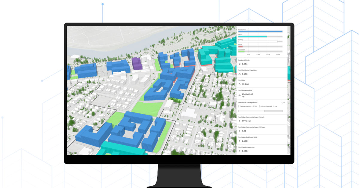
5. Smart City Development
GIS is the backbone of smart cities, integrating real-time data from sensors and infrastructure systems to improve:
Traffic flow
Waste management
Energy efficiency
Public service delivery
Platforms like Google Earth also enhance visualization and accessibility of spatial data.
Real-World Impact of GIS
Cities globally are leveraging GIS to:
Reduce traffic congestion
Improve urban mobility
Optimize land use
Enhance service delivery
This makes GIS a critical tool for both public and private sector decision-making.
Why GIS Skills Are Essential Today
Modern professionals are expected to go beyond traditional roles. Today’s urban planner or surveyor must understand:
Spatial data analysis
Digital mapping tools
Remote sensing technologies
GIS skills are now in high demand across industries including planning, engineering, environmental management, and infrastructure development.
Conclusion
GIS is redefining urban planning by transforming raw data into actionable insights. It enables smarter decisions, more efficient infrastructure development, and sustainable city growth.
As urban challenges continue to grow, GIS will remain at the center of innovation in planning and development.
For students, professionals, and decision-makers alike, embracing GIS is no longer optional — it is essential.
Call to Action
Stay Updated with Weekly GIS Insights
Subscribe to receive weekly articles on Geospatial Technology, GIS, and Modern Surveying.
👉 Coming soon: Email subscription form